Why Is El Yunque So Special?
El Yunque is the only tropical rainforest in the U.S. National Forest System, a 28,516-acre mountain forest with no entry fee, no reservation, and rainfall measured in feet. Here is what actually makes it different.
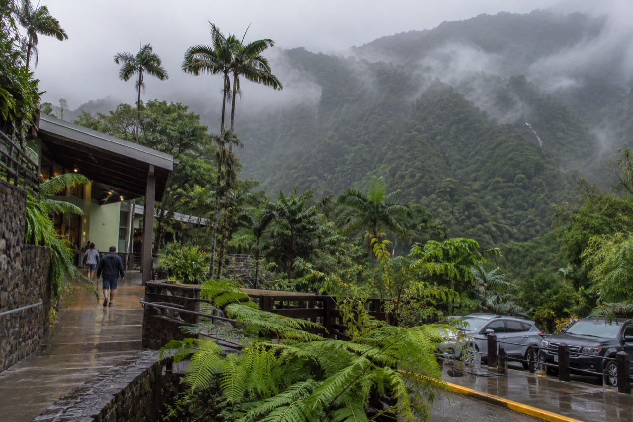
Why Is El Yunque So Special?
El Yunque is the only tropical rainforest within the national forest system, a 28,516-acre forest spread across eight municipalities in northeastern Puerto Rico, where annual rainfall runs from roughly 96 inches at lower elevations to more than 157 inches near the summit. No other unit of the National Forest System is a tropical rainforest, and no other is managed quite like this one. That single sentence holds most of the answer, but the parts worth knowing are the details underneath it: a road network and stone towers built by Depression-era labor, a wilderness area that is also the only tropical wilderness in the system, an endangered parrot saved from near-extinction inside these boundaries, and an access policy that is the opposite of what most visitors expect.
Start with what the forest itself says. The USDA Forest Service describes El Yunque as "the only tropical rainforest within the national forest system," extending through Río Grande, Luquillo, Canóvanas, Fajardo, Naguabo, Ceiba, Las Piedras and Juncos, at nearly 29,000 acres one of the smallest national forests in size yet one of the most biologically diverse. That combination, small and extraordinarily rich, is the first genuinely unusual thing about it. You can cross the whole recreational corridor in a morning. You cannot see all the life in it in a week.
The second unusual thing is administrative rather than scenic, and it matters more than it sounds. This is not a national park. It is a National Forest, managed by the USDA Forest Service under a multiple-use mandate, which is why entry works the way it does: free, no reservation, managed by parking. If you have read that you need to book a timed-entry slot, you have read outdated copy. The Forest Service's own conditions page states plainly that entrance to the PR-191 North recreational corridor in Río Grande is free and no reservations are required, with hours from 8:00 a.m. to 5:00 p.m. The old reservation system is gone.
The third thing is the one people remember after the visit: the water. Rain here is not an event, it is the climate. A research publication from the Forest Service's International Institute of Tropical Forestry puts annual rainfall between 2,450 mm at lower stations and more than 4,000 mm at higher ones, with the single wettest station, on El Yunque Peak itself, recording about 4,300 mm in a year. Everything about the forest, from the moss on the stairs to the coquí frogs at night, follows from that.
If you are still deciding whether a day here is worth it, the honest answer is that the forest earns its reputation on substance rather than superlatives, and a good guide sharpens the day considerably. These are three ways people usually structure a first visit:
What Does "Only Tropical Rainforest In The National Forest System" Actually Mean?
The national forest system spans forests across the country, and exactly one of them is a tropical rainforest. El Yunque holds that distinction alone, and inside it sits the El Toro Wilderness, the only tropical wilderness in the U.S. National Forest System, designated in 2005 around the forest's highest peak at 3,524 feet. These are official designations, not marketing phrases, and they explain why this small forest draws disproportionate attention.
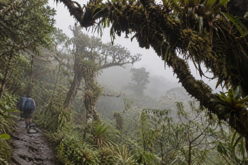
The national forest system stretches from Alaska to the Caribbean, and almost all of it is temperate: pine, fir, aspen, oak. El Yunque is the exception, a montane tropical rainforest where the tree communities change as you climb, from tabonuco forest in the lowlands through Colorado forest and palm forest into cloud forest at the top. The Forest Service's own description of Yokahú Tower lists four forest types visible from a single viewpoint. That vertical compression is rare. In the western United States you would drive for hours to move through four forest zones; on PR-191 you do it in about twenty minutes of switchbacks.
The El Toro Wilderness adds a second layer of distinction. Designated in 2005 and named for the highest peak in the forest, it is, in the Forest Service's own words, "the only tropical wilderness in the U.S. National Forest System." The habitat list on the El Toro Trail page reads like a conservation index: the endangered Elfin Woods Warbler, the Puerto Rican Boa, the Desmarest's red fig-eating bat, five species of coquí, and the Puerto Rican Parrot, plus an orchid, Lepanthes eltoroensis, that grows essentially nowhere else. The trail itself is historic, built by the Civilian Conservation Corps in the 1930s, and it is a genuinely difficult walk, 2.3 miles with 1,325 feet of climbing on the Road 186 side of the forest.
There is a phrasing trap worth avoiding, because you will see it everywhere. El Yunque is the only tropical rainforest in the national forest system; it is not "the only tropical rainforest in the United States," which is a claim the Forest Service does not make and which is not accurate. The precise wording matters if you care about being right, and this site cares about being right, which is why you will find the distinction drawn on nearly every page here, including our overview of El Yunque National Forest Tours.
The designation also explains the forest's scientific weight. The International Institute of Tropical Forestry, a Forest Service research unit, is headquartered in Puerto Rico and has studied this forest for decades, producing long-term rainfall and ecology records that go back generations. Very few rainforests anywhere have been instrumented and written about this thoroughly. When you read a rainfall figure for El Yunque on this site, it traces to that research record, not to a brochure.
Still deciding how to spend the day? A guide does not buy you special entry, because there is none to buy, but a permitted operator solves the parking problem, handles the driving, and knows which trails are actually open on the day.
How Much Rain Does El Yunque Really Get?
Annual rainfall ranges from about 2,450 mm, roughly 96 inches, at lower elevations to more than 4,000 mm, about 157 inches, at higher stations, and the wettest station, on El Yunque Peak, has recorded around 4,300 mm, close to 169 inches in a year. That is between eight and fourteen feet of rain annually, and it falls unevenly through the year, so a wet visit is normal, not bad luck.
The numbers come from a peer-reviewed synthesis published by the International Institute of Tropical Forestry, and they deserve a moment of respect. For comparison, famously rainy Seattle gets under 40 inches a year. El Yunque's lower slopes receive more than double that, and the upper slopes receive quadruple. One station, La Mina, recorded annual totals varying between 3,730 and 6,450 mm across an eight-year span, meaning in its wettest year that single spot received more than 250 inches of rain. There is no honest version of "hope it stays dry" in a place with these numbers.
What that water does to the landscape is the real point. It carves the rivers that make the forest's swimming spots possible, feeds the waterfalls that draw most visitors, and keeps every stone surface slick, which is why the Forest Service's own preparation advice leads with footwear: "Wear good shoes with traction: it is a rainforest, and it is wet and mossy. Wet surfaces can be a hazard and even more so if it's on a slope." That is the agency telling you, in its own voice, that the trails here demand respect.
| Elevation zone | Approximate annual rainfall | What that means on the ground |
|---|---|---|
| Lower elevations | about 2,450 mm, near 96 inches | Lush tabonuco forest, frequent afternoon showers |
| Higher stations | over 4,000 mm, about 157 inches | Cloud forest, moss on every surface |
| El Yunque Peak station | around 4,300 mm, close to 169 inches | The wettest recorded point in the forest |
| La Mina station, wettest recorded year | up to 6,450 mm, over 250 inches | A single extreme year, not an average |
The rain also brings the forest's most serious hazard: flash floods. The Forest Service warns that flash floods can occur throughout the year and are more frequent in the rainy months of April and May, that a sudden surge can claim victims in less than one minute, and that flood water can reach heights of 30 feet or more. If you plan to swim at one of the listed spots, the Angelito Trail on the Luquillo side or Juan Diego Falls on PR-191, check conditions before you go. The Río Mameyes even has a live USGS stream gauge publishing real-time discharge, so you can literally check the river before you get in it.
Rain shapes the visit in smaller ways too. Clouds sit on the peaks most afternoons, which is why Yokahú Tower's famous view of the coastline, and on clear days the Virgin Islands, is a morning reward. The trade-off is honest: come early for views, come any time for the rain itself, because the mist moving through the palm forest is the experience. If you want a fuller treatment of visiting on a wet day, our guide to El Yunque in the rain covers what changes and what does not.
What Wildlife Makes This Forest Unusual?
El Yunque's signature animals are the coquí frogs, tiny tree frogs whose night call defines the Puerto Rican soundscape, and the Puerto Rican Parrot, one of the most endangered birds in the world, which survived near-extinction partly inside this forest. Add the Puerto Rican Boa and five coquí species in the El Toro Wilderness alone, and the wildlife list of this small forest reads like a conservation casebook.
The coquí is the one you will notice. Roughly the size of a coin, it sings its own name, "ko-KEE," and in a wet forest at dusk the combined call is loud enough that first-time visitors often ask what machinery is running. There are multiple species across the island, and the El Toro Trail page alone lists five within the wilderness area. They are the audible proof of the rainfall numbers: a frog that lays eggs on land instead of in water can only thrive where everything is permanently damp.
The Puerto Rican Parrot is the harder and more remarkable story. By the 1970s the wild population had collapsed to a handful of birds, and recovery work, some of it centered on this forest, has slowly rebuilt the species. El Portal, the visitor center on PR-191, keeps an exhibit with live parrots, and the Forest Service's FAQ describes them as part of the center's permanent offering. Seeing one in the wild still takes luck. Knowing they are there changes how the forest feels.
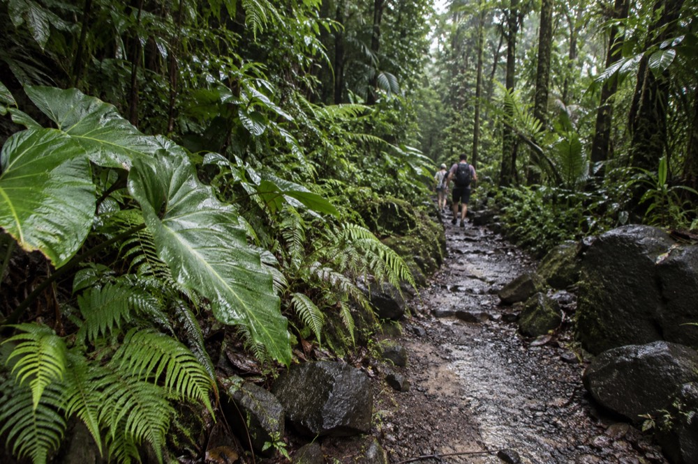
The plant side deserves equal billing even though it is quieter. The forest's vertical zones, tabonuco, Colorado, palm and cloud forest, each carry their own communities, and the Elfin Woods Warbler, another endangered species, lives in the high dwarf forest near the peaks. The orchid Lepanthes eltoroensis is found essentially only in the El Toro Wilderness. Biodiversity per acre here is exceptional, which is exactly what the Forest Service means when it calls El Yunque one of the smallest forests in size yet one of the most biologically diverse.
One caution that belongs in any honest wildlife paragraph: the forest's snakes and big-cat rumors are mostly noise. There are no jaguars in El Yunque, and the Puerto Rican Boa, while real and protected, is a shy constrictor you are unlikely to see. The animals that will actually define your visit are the coquís, the lizards on the railings, and, if the day is generous, a parrot silhouette.
Why Is So Much Of El Yunque Built Of 1930S Stone?
The stone towers, picnic shelters, dams and trail steps across El Yunque were built by the Civilian Conservation Corps in the 1930s and 1940s, and much of that masonry is still in daily use. Mount Britton Tower went up in 1937–38, Baño Grande's dam-and-pool structure dates to the late 1930s, and the Road 191 corridor itself was largely constructed by CCC labor. Few rainforests anywhere carry this much visible New Deal history.
This is the layer most visitors walk past without knowing what they are looking at. Mount Britton Tower, the stone observation tower at 3,087 feet, was built by the CCC in 1937–38 and is described by the Forest Service as the tallest of the CCC towers built with stone masonry. Los Picachos, a stone platform at 3,175 feet with a 360-degree view, is CCC work from the same era. The picnic shelters near the old La Mina trailhead were built of native stone by the CCC in the 1930s. The road you drive in on, PR-191 North, and most of the recreation sites along it, were constructed during the 1940s by the same workforce, per the Forest Service's corridor page.
Baño Grande is the strangest artifact of that era. It is a man-made pool, 18 feet deep, formed by a stone and masonry dam built in the late 1930s, and the Forest Service calls it the largest and most impressive man-made swimming pool in the La Mina Recreation Area. It was in continuous use as a swimming pool from 1936 to 1968, when it was closed to swimmers over safety concerns and became a scenic spot. Today it is explicitly posted "No swimming permitted," a detail worth repeating because plenty of third-party copy still gets it wrong. The structure is now described as one of the best-preserved examples of New Deal-era concrete and masonry construction in Puerto Rico.
Baño de Oro tells the same story from another angle. Built in the mid-1930s by the CCC in pits left by Spanish gold seekers in the 16th century, it features the first concrete pool and house built in Puerto Rico, is a registered National Historic Property, and spent eight years closed after Hurricane María before its trail and historic site were restored. The trail reopened after that long closure, though trail status in this forest changes with construction and storm repair, so the alerts page is the live authority rather than any article, including this one.
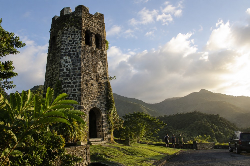
Why does this matter to why the forest is special? Because it means El Yunque is not just a natural wonder with a road through it. It is a designed landscape, one the federal government invested Depression-era labor into at a scale visible from every overlook. The hurricanes of 2017 damaged a great deal of it, and the recovery has been slow and ongoing, which is why some trails stay closed for years while others reopen. The forest you visit today is nature and restoration layered together, and the stone is the evidence.
Is It True That El Yunque Is Free To Enter?
Yes. Entrance to the PR-191 North recreational corridor is free and requires no reservation, with hours from 8:00 a.m. to 5:00 p.m., and all four forest corridors are published as not requiring a reservation. The only charge inside the forest is at El Portal, the visitor center, which costs $8 for visitors 16 and over and is free for under-15s, or $4 with an interagency pass.
This is the fact this site exists to get right, because so much of the internet still gets it wrong. There is no timed-entry reservation for El Yunque any more. The old recreation.gov reservation facility no longer exists; a search of recreation.gov for El Yunque returns exactly one bookable product, the El Portal visitor center ticket. The Forest Service's conditions page and its FAQ both state the free, no-reservation policy directly, and the FAQ adds a detail worth knowing: the corridor closes right at 5:00 p.m., and visitors are advised to begin exiting at least 15 minutes before closing.
What is managed instead is parking. Capacity is limited by parking and by ongoing construction, and parking is permitted only in designated areas, with ticketing enforced at La Coca Falls and 30-minute maximums at Yokahú Tower and Juan Diego. That is the honest case for a guided tour in one sentence: not queue-skipping, which does not exist here, but a permitted vehicle, a legal drop-off, and someone else absorbing the parking problem. Rideshare apps cannot pick up at the corridor or El Portal, a situation the Forest Service has publicly warned about, so a visitor without a car can genuinely get stuck walking out.
Two fee details complete the picture. El Portal's tickets are available on recreation.gov 30 days in advance at 9 a.m. ET, and the center is open 8 a.m. to 4 p.m. And a fee proposal announced in May 2026 would restructure El Portal pricing and add a La Mina Recreation Area day fee, but it is proposed only: the comment period closed in August 2026 with no decision published, and the forest's own release notes that only about 2 percent of the national forest carries a proposed fee. Nothing about the current free entry has changed. Our page on El Yunque tickets and reservations covers the mechanics in full.
What Are The Quieter Reasons The Forest Feels Different?
Beyond the superlatives, El Yunque feels different because it is a rainforest you can drive into on a paved road, swim in at Forest Service listed spots, and leave the same afternoon, all within an hour's reach of a major city and a cruise port. The scale is intimate, the infrastructure is human-scaled 1940s masonry, and the sound of the coquís at night is unlike anything on the mainland.
Consider the strangeness of the basic experience. In most of the world, a tropical rainforest visit means a boat, a lodge, a guide with a machete and a long drive. Here it means a paved mountain road with stone towers, roadside waterfalls, a visitor center with a restaurant, and swimming holes with Forest Service signage, all inside a forest of 28,516 acres that the forest supervisor says welcomes a million visitors a year across its 360-acre special recreation area. That accessibility is the quiet miracle. The rainforest came with a road, and the road came with the CCC.
The swimming is part of it, with an honest caveat. The famous falls are not swimmable: La Coca Falls is viewing only, Baño Grande has been closed to swimmers since 1968, and La Mina Falls is reached only by trails that have been closed for construction. But the Forest Service does list real swimming opportunities, including the Juan Diego Falls pool, the Angelito Trail's Las Damas Pool on the Río Mameyes, Puente Roto, Quebrada Grande, Quebrada Sonadora, the Río Espíritu Santo Observation Point and the Río Sabana Recreation Area. Each carries the flash-flood warning, and each deserves it. Our article on whether you can swim at El Yunque sorts the real spots from the marketing.
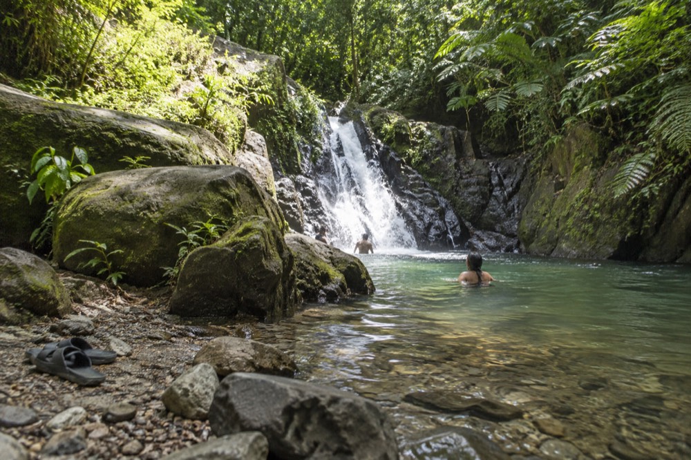
Then there is the water beyond the forest boundary, which is where honesty requires a boundary of its own. The natural waterslides above Luquillo, the ones that headline many tour listings, sit on private land outside the national forest, with no Forest Service management, staffing or oversight. That does not make them not fun; it makes them a different kind of activity, and a tour that includes them is selling a mixed day, part national forest, part private land. We lay out exactly what that means in our guide to the Luquillo waterslides, because knowing what you are buying is the difference between a good day and a misleading one.
The last quiet reason is the night. A small-group nature walk after dark, or simply standing outside your lodging in Río Grande or Luquillo, delivers the coquí chorus at full volume, and the forest's nocturnal layer, the bats, the frogs, the cloud moving downhill, is when the rainfall numbers become audible. It is the part no photograph captures and the reason people who came for a waterfall photo often describe the sound instead.
If any of that has moved you from deciding toward planning, these are the three formats that fit the forest best: a half-day with a guide you meet on site, a longer slides-and-waterfalls loop, or a full day pairing a hike with ziplining on the forest's edge.
Common Questions About El Yunque
Why Is El Yunque So Special?
El Yunque is the only tropical rainforest within the national forest system, a 28,516-acre forest across eight municipalities in northeastern Puerto Rico, receiving up to roughly 169 inches of rain a year near its highest peak. It combines that ecology with 1930s Civilian Conservation Corps stonework, free entry with no reservation, and the only tropical wilderness in the U.S. National Forest System, the El Toro Wilderness.
Is El Yunque a national park?
No. It is a National Forest managed by the USDA Forest Service, not a unit of the National Park System. That distinction is why entry is free, why the corridor is managed around parking rather than tickets, and why the only charge inside the forest is El Portal visitor center's $8 admission for visitors 16 and over.
Can you swim in El Yunque?
Yes, at the spots the Forest Service itself lists as swimming opportunities: the Juan Diego Falls pool, the Angelito Trail and Las Damas Pool on the Río Mameyes, Puente Roto, Quebrada Grande, Quebrada Sonadora, the Río Espíritu Santo Observation Point and the Río Sabana Recreation Area. La Coca Falls is viewing only, Baño Grande has been closed to swimmers since 1968, and the trails to La Mina Falls have been closed for construction. Flash floods are a serious, documented hazard on all of these rivers.
Do you need a reservation to visit El Yunque?
No. Entrance to the PR-191 North recreational corridor is free and no reservations are required, with hours from 8:00 a.m. to 5:00 p.m. The old timed-entry reservation system no longer exists. The only bookable item is the El Portal visitor center ticket, $8 for adults 16 and over, free for under-15s.
What is the best time of day to visit?
Morning, for two practical reasons: clouds typically sit on the peaks by afternoon, hiding the coastal views from Yokahú Tower, and parking, the forest's real capacity constraint, fills early. The corridor closes at 5:00 p.m. and visitors are advised to begin exiting 15 minutes before closing.
Are the Luquillo waterslides part of El Yunque?
No. The natural waterslides above Luquillo sit on private land outside the national forest boundary, with no Forest Service management or oversight. Tours that include them are selling a mixed day, part national forest, part private property, and should be understood that way before you book.