Is El Yunque The Only Tropical Rainforest In The US Forest System?
Yes, El Yunque is the only tropical rainforest in the US National Forest System, and that fact shapes everything about a visit, from the rain to the trails to the tours.
Is El Yunque The Only Tropical Rainforest In The US Forest System?
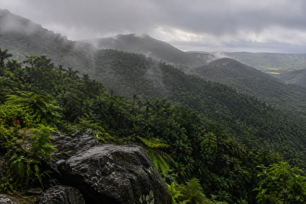
Yes. The USDA Forest Service describes El Yunque as the only tropical rainforest within the national forest system, spread across nearly 29,000 acres in northeastern Puerto Rico. No other unit in the roughly 150-forest system is a tropical rainforest, because every other national forest sits on the North American mainland in temperate, boreal or dry ecosystems. That single sentence is the reason a day here feels nothing like a day in a mainland forest, and it is worth understanding before you plan anything.
The exact wording matters, because travel content gets it wrong constantly. The Forest Service's own phrasing is that El Yunque is "the only tropical rainforest within the national forest system," on its main page for the forest. Two common distortions of that sentence circulate widely. The first calls it "the only tropical rainforest in the United States," which is a broader claim than the Forest Service makes and one the agency does not stand behind. The second calls it a national park, which it is not: El Yunque is a National Forest, managed by the USDA Forest Service, not the National Park Service. The distinction is not pedantry. It determines who runs the land, what the fees are, and which passes work at the gate.
This article walks through what the designation means in practice: how the forest compares with anything you could drive to on the mainland, what the climate actually does to the landscape, why the El Toro Wilderness inside it carries a second "only" of its own, and how all of this should shape the tour you book, if you book one at all.
What Does "Only Tropical Rainforest In The National Forest System" Actually Mean?
Out of more than 150 units in the National Forest System, El Yunque is the only one classified as a tropical rainforest, which means it is the sole place in the entire system where that ecosystem can be experienced. Every other national forest in the United States and its territories falls outside the tropical rainforest category. The forest covers 28,516 acres, or 11,540 hectares, across eight municipalities in northeastern Puerto Rico: Río Grande, Luquillo, Canóvanas, Fajardo, Naguabo, Ceiba, Las Piedras and Juncos. Every other national forest sits in a temperate, Mediterranean, boreal or dry island ecosystem, and none of them receives the year-round heat and rainfall that define a true tropical rainforest. That is the whole meaning of the label, and it is the Forest Service's own.
Start with what the system is. The National Forest System is the network of federal lands the USDA Forest Service manages, mostly on the mainland: the enormous forests of the Rockies, the Cascades, the Appalachians, the lake states. Some of those forests are rain-soaked by mainland standards, the Olympic Peninsula's temperate rainforest being the famous example, but a temperate rainforest and a tropical rainforest are different things. A temperate rainforest has cool winters and a concentrated wet season. A tropical rainforest has heat and rain all year, no dormant season, and vegetation that never stops growing. El Yunque is the only unit in the system in that category.
The Forest Service's own description, on the forest's main page, is worth reading in full. It notes that El Yunque is one of the smallest national forests in size, "yet one of the most biologically diverse." That pairing, tiny and extraordinarily rich, is the signature of tropical ecology: more species packed into fewer acres than almost any temperate forest can manage. The forest extends through those eight municipalities at nearly 29,000 acres, a modest footprint by the standards of western forests that run to millions of acres, and a huge one by the standards of biological density.
There is a related claim you will see on souvenir shirts and in casual travel writing, that El Yunque is the only tropical rainforest "in the United States." Be careful with that one. The Forest Service does not publish it, and the reason is probably that it invites arguments about other tropical holdings under other agencies. The verified, defensible sentence is the agency's own: the only tropical rainforest within the national forest system. It is also the only one you can drive to from San Juan in a morning, though no official source publishes a drive time, so treat any figure you see on that as a tour operator's estimate rather than a fact.
For a reader deciding whether to come, the honest framing is this: you cannot see anything like this anywhere else in the national forest system, and you cannot see it anywhere on the mainland at all. If your trip to Puerto Rico includes one natural destination, the uniqueness argument is real, not marketing.
How Does El Yunque Compare With Mainland National Forests?
El Yunque is far smaller than nearly every mainland national forest, yet it receives dramatically more rain, supports denser tropical biodiversity per acre, and is managed around steep mountain watersheds rather than wide open basins, making it a compact but intense contrast to the sprawling, drier forests of the mainland United States. Its 28,516 acres would fit inside many western forests hundreds of times over, yet its rainfall, elevation packing and species density produce a landscape those forests cannot match. The comparison explains why the trails here are short, steep and often slippery rather than long and dry, and why a visit runs on a different clock.
The most concrete difference is water. Research published by the Forest Service's International Institute of Tropical Forestry, drawing on long-term station data, finds that annual rainfall in the Luquillo Experimental Forest ranges from about 2,450 millimeters at lower elevations to over 4,000 millimeters at higher stations. That is roughly 96 inches to 157 inches a year, and the single highest station, at El Yunque Peak, recorded about 4,300 millimeters, around 169 inches. A mainland forest that receives 40 inches a year is considered well watered. El Yunque's lower slopes get more than double that, and its upper slopes approach four times that. The forest's own weather station at La Mina recorded annual totals varying between 3,730 and 6,450 millimeters over an eight-year period, the upper end of which is over 250 inches.
Then there is the vertical packing. El Toro Peak, the highest point in the forest, stands at 3,524 feet, and Los Picachos sits at 3,175 feet. Those are modest mountains by mainland standards. What is not modest is how fast the forest changes as you climb. The Forest Service describes distinct forest types stacked on top of each other: Tabonuco forest at the lower elevations, Colorado forest higher up, Palm forest above that, and Cloud Forest near the summits, where the trees are stunted and draped in moss. On a single drive up the PR-191 corridor you pass through zones that on a mainland mountain would be separated by hundreds of miles of latitude.
The management differences follow from the ecology. Mainland forests often center on wide basins, long road networks and dispersed recreation. El Yunque's recreation is concentrated in one main corridor on PR-191 North in Río Grande, with three quieter entrances on the Luquillo, Naguabo and El Toro sides. Capacity is managed through parking, not entry tickets: entrance to the recreational corridor is free, no reservation is required, and the corridor is open 8:00 a.m. to 5:00 p.m. The only thing that charges admission is El Portal de El Yunque Rainforest Center, the visitor center, at $8 for visitors 16 and over, free under 15, and $4 with an interagency pass.
| Comparison point | El Yunque | Typical mainland national forest |
|---|---|---|
| Ecosystem | Tropical rainforest, the only one in the system | Temperate, boreal, Mediterranean or dry forest |
| Size | 28,516 acres across eight municipalities | Often hundreds of thousands to millions of acres |
| Annual rainfall | Roughly 96 to 169 inches depending on elevation | Commonly 15 to 60 inches |
| Managing agency | USDA Forest Service | USDA Forest Service |
| Entry | Free, no reservation, 8 a.m. to 5 p.m. corridor hours | Usually free; some fee sites |
| Forest types | Four stacked zones on one mountain | One or two zones across vast areas |
One more contrast worth naming: the Forest Service publishes a directory of authorized and permitted tour operators for El Yunque, currently 26 listed operators, and warns that not every taxi holds a forest permit. On a mainland forest, a visitor with a car and a trailhead map is largely self-sufficient. Here, the combination of limited parking, rideshare restrictions and frequently changing trail status makes local knowledge genuinely valuable, which is the honest case for a guided day rather than any claim about skipping lines.
Does The "Only Tropical Rainforest" Label Change What You'll See On The Ground?
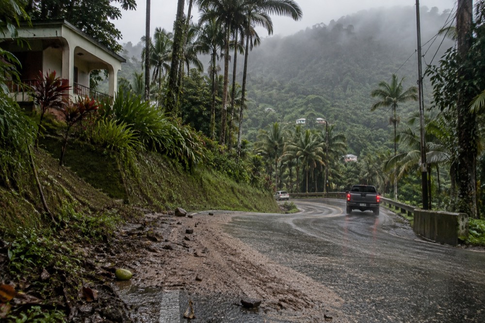
Yes, the label translates directly into what you encounter on the ground. You will find near-constant moisture, a mountain whose slopes stack distinct ecological zones on top of one another, and wildlife that exists nowhere else in the forest system. The rain shapes every surface you walk on, the elevation packing puts four distinct forest types on a single peak, and the isolation of a tropical island ecosystem has produced species no mainland forest holds, including the endangered Puerto Rican Parrot and the coquí frogs you will hear all night long.
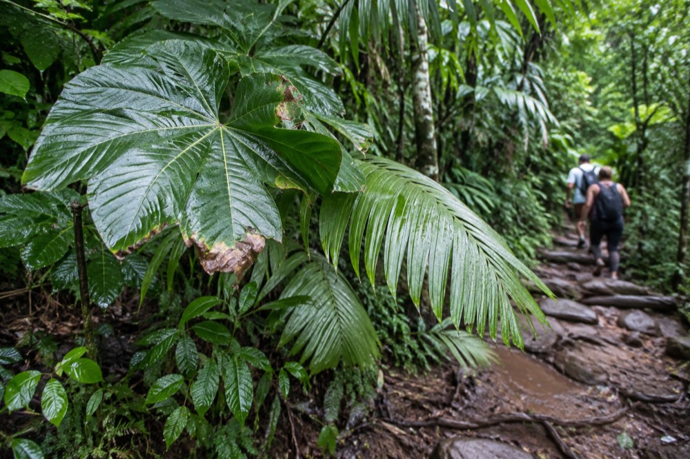
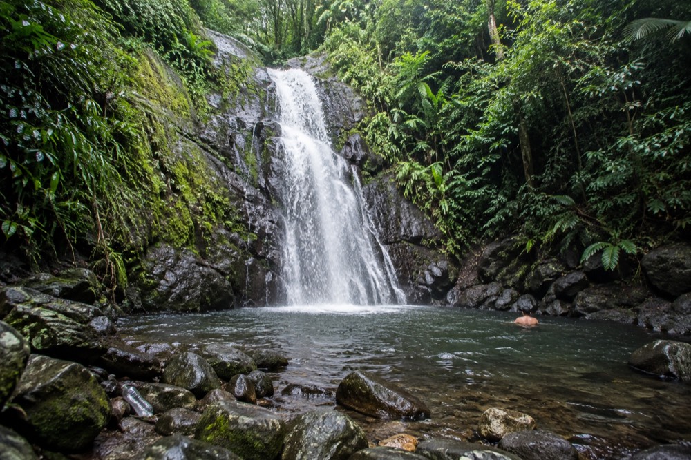
Start with the water, because it is the first thing you notice. The Forest Service's own preparation advice leads with footwear: wear good shoes with traction, because "it is a rainforest, and it is a wet and mossy. Wet surfaces can be a hazard and even more so if it's on a slope." That is not boilerplate. Trails here are stone stairs, packed earth and boardwalk sections that stay damp even in dry spells, and the flash-flood risk in the river drainages is real. The agency warns that flash floods can occur throughout the year, more often in the rainy months of April and May, and that a sudden surge can claim victims in less than one minute. Any swim stop on a tour, and there are legitimate ones at Forest Service listed sites like the Juan Diego Falls pool and the Las Damas Pool on the Río Mameyes, comes with that warning attached.
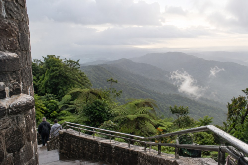
The vertical stacking is the second visible difference. On the drive or hike up, the forest changes character in a way that feels almost theatrical. Lower slopes hold tall Tabonuco trees, the mid-slopes shift to Colorado forest with their distinctive twisted trunks, the palm forest appears as you climb, and near the tops the cloud forest takes over, dense, low and permanently wet. Yokahú Tower, a 69-foot stone observation tower built in the early 1960s, is a good vantage for reading those layers, and on a clear day the view runs past the coastline toward the Virgin Islands.
The third difference is the wildlife. The forest is home to the endangered Puerto Rican Parrot, one of the rarest birds in the world, and the Forest Service notes five species of coquí frogs in the El Toro Wilderness alone. The coquí chorus is the sound of the Puerto Rican night, and no mainland forest has anything like it. The biological density the Forest Service highlights, "one of the smallest in size, yet one of the most biologically diverse" national forests, is not an abstraction. It is the reason a two-hour walk here can turn up more species than a two-day backpacking trip in many western forests.
If this dense, wet, layered landscape is what you came for, a tour that gets you off the main corridor and into the quieter watersheds is one way to see it properly. The Hidden Off The Path Waterfall Hike does exactly that, five hours with transport included, rated 4.7 across 34 reviews, from $115, taking in the Río Espíritu Santo on the forest's quieter side.
Is El Yunque A National Park?
No, El Yunque is not a national park. It is a National Forest, managed by the USDA Forest Service rather than the National Park Service, which means it is not a unit of the National Park System. This distinction is more than a matter of naming, since forests and parks operate under different agencies, missions, and management practices. It determines the managing agency, the fee structure and which passes are honored at the gate. Interagency passes are accepted at El Portal, but there is no national-park entry gate, no park pass requirement and no NPS framing anywhere in the forest's official materials or its history.
The confusion is understandable. El Yunque is Puerto Rico's most famous natural attraction, it appears on countless "must see" lists alongside national parks, and its visitor center, El Portal, feels a bit like a park visitor center. But the land has been Forest Service territory since before the National Park Service existed in its modern form. The forest began as the Luquillo Forest Reserve, was designated a national forest in the early twentieth century, and took the name El Yunque in 2007. It is administered from a supervisor's office in Río Grande, and its official status is exactly what the name says: a national forest. Other pages covering the same trip are gathered on El Yunque National Forest Tours.
The practical differences for a visitor are concrete. Entrance to the recreational corridor is free, with no reservation, unlike the timed-entry systems many national parks run. The only admission charge is El Portal, the visitor center, at $8 for those 16 and over and free for under-15s, with interagency pass holders paying $4. Camping, which many national parks offer, is currently not available in El Yunque at all: the Forest Service states that camping permits are not available and dispersed camping sites are closed until further notice. And the recreation is managed around parking capacity in collaboration with the Puerto Rico Police, which is why the corridor can fill and close on busy days even though entry itself costs nothing.
For readers planning a broader Puerto Rico itinerary, this also matters for expectations. A national park visit is usually a full-day, gate-to-gate experience. El Yunque is more modular: a half-day sightseeing loop, a morning hike, a river stop and a beach afternoon are all realistic combinations, which is exactly what the tour operators on the roster build their itineraries around.
What Is The El Toro Wilderness, And Why Does It Hold A Second "Only"?
Inside El Yunque sits the El Toro Wilderness, a 10,000-acre protected expanse that the Forest Service describes as the only tropical wilderness in the U.S. National Forest System, giving this corner of Puerto Rico a second "only" stacked inside the first. Designated in 2005 and named after the forest's highest peak at 3,524 feet, it protects habitat for the endangered Elfin Woods Warbler, the Puerto Rican Boa, the Puerto Rican Parrot and five species of coquí, along with the tiny orchid Lepanthes eltoroensis that grows nowhere else on earth.
Wilderness designation is the strictest form of protection in the federal land system: no roads, no permanent structures, no mechanized equipment, land managed to stay wild. There are hundreds of designated wilderness areas across the National Forest System, from desert canyons to alpine ridges, and precisely one of them is tropical. That makes El Yunque a double rarity, the only tropical rainforest in the system and the home of the only tropical wilderness in it.
The El Toro Trail, which reaches the peak from the PR-186 side, is a 2.3-mile, 3.8-kilometer route with 1,325 feet of elevation gain, rated Difficult, built in the 1930s by the Civilian Conservation Corps. The Forest Service describes it as roughly a three-hour hike to the summit. It is a different experience from the main PR-191 corridor: quieter, harder, and on the forest's least-developed side, reached by the El Toro Scenic Byway on Road 186, which the agency flags for poor road conditions and careful driving.
For most visitors, the practical takeaway is that El Yunque contains landscapes at both ends of the development spectrum: a busy, paved corridor with towers and waterfalls, and a protected wilderness where the trail signs end. A guided tour almost always works the first; the second rewards independent hikers who have checked the current trail status before setting out.
Does Being The Only Tropical Rainforest Make It Worth A Guided Tour?
Yes, because while you can explore the only tropical rainforest in the network on your own, a guided tour handles the practical realities that trip up most visitors. Limited parking, rideshare restrictions, and frequently changing trail closures make navigating the area difficult, so a permitted tour with an experienced operator is a genuinely practical choice for getting the most from your visit. Entry is free and no reservation exists, so a tour buys no special access to the forest itself. What it buys is a permitted vehicle, a legal drop-off and pick-up, and a guide who knows what is actually open on the day you go.
Be clear about what a tour does not do here, because some marketing implies otherwise. There is no reservation system to skip, because there is no reservation system. The old timed-entry arrangement on the federal booking site no longer exists, and the Forest Service states plainly that entrance to the PR-191 North corridor is free with no reservations required. Any tour pitch built on "we handle your entry permit" is selling you something that is not for sale, because it does not need to be bought.
What a tour does solve is real. The Forest Service warns that the recreational corridor and El Portal are not pick-up points for rideshare apps, and that visitors relying on them have been forced to walk long distances to reach a valid pick-up point. The agency also notes that not every taxi driver holds a permit to operate in the forest, and tells visitors to ask before hiring any transportation service. If you have no rental car, a permitted tour operator is one of the few ways in and out that is guaranteed to work.
Parking is the other argument. Capacity in the corridor is managed because of parking limitations, parking is permitted only in designated areas, and the enforcement is real: La Coca Falls posts that violators will be ticketed, and Yokahú Tower and Juan Diego both carry 30-minute parking maximums. A tour vehicle with a legal drop-off removes that entire calculation from your morning.
Then there is the knowledge. Trail status in El Yunque changes with construction and storm recovery, and the Forest Service's alerts page is the live authority on what is open. A guide who works the forest weekly knows which trailheads are reachable, which river pools are safe after rain, and how to read the weather that rolls in off the mountains. In a forest where flash floods can surge in under a minute, that judgment has value beyond convenience.
If you are weighing the decision, our piece on whether El Yunque tours are worth the price breaks down the costs, and the guide to El Yunque tickets and reservations covers the entry facts in detail. For the forest's quieter side, the Hidden Off The Path Waterfall Hike covers the Río Espíritu Santo watershed with transport included, and the island day tour with an El Yunque visit, rated 4.9 across 1,655 reviews from $89, pairs the forest with coastal stops like La Coca Falls, Yokahú Tower and Piñones with hotel pickup.
How Should The Designation Shape Your Planning?
Because a tropical rainforest designation means frequent rain, limited visiting hours, and crowds that arrive early, you should plan your visit around the forest's own rhythm rather than your vacation's: check the official opening times, expect showers at almost any moment, and arrive as close to opening as possible so you have the best chance of dry trails and quieter paths. The corridor opens at 8:00 a.m. and closes at 5:00 p.m., the Forest Service advises starting your exit fifteen minutes before closing, and afternoon clouds and showers are a feature of the climate rather than a sign of bad luck on your particular day.
The rainfall numbers deserve one more mention because they should calibrate your expectations. Somewhere between 96 and 169 inches of rain falls here every year depending on elevation, and the forest's research stations have recorded single-year totals above 250 inches at the wettest gauge. Practically, that means you go expecting to get wet or at least damp, you bring traction on your feet, and you keep valuables dry. Our what to wear and bring guide covers the packing list in detail, and the advice on visiting El Yunque in the rain is worth reading if your dates land in the wetter months.
Timing matters more here than at a typical mainland forest. The corridor's hours are fixed, parking fills on weekends and holidays, and the mountain weather tends to deteriorate as the day goes on. Arriving early gets you the clear morning views from the towers and the calm water at the river pools before both clouds and crowds build. The Forest Service's digital maps, now published paper-free for each corridor, are the best planning resource, and the alerts page is the only authoritative source for what is open on your date.
Finally, choose your tour, if you take one, for what it actually offers rather than for entry promises. Transport from San Juan, a permitted vehicle, a small group, a guide who reads the weather, and stops that match your interests, whether that is a quiet waterfall hike, a full island day, or a zipline adventure on the forest's edge, are the real variables. The uniqueness of the forest is free. The logistics are what you are paying for.
Common Questions About El Yunque's Designation
Is El Yunque The Only Tropical Rainforest In The US Forest System?
Yes. The USDA Forest Service describes El Yunque as the only tropical rainforest within the national forest system. It spans 28,516 acres across eight municipalities in northeastern Puerto Rico and is one of the smallest yet most biologically diverse national forests.
Is El Yunque a national park?
No. El Yunque is a National Forest managed by the USDA Forest Service, not a National Park Service unit. Entrance to the recreational corridor is free with no reservation required, and the only admission charge is $8 at the El Portal visitor center for visitors 16 and over.
Is El Yunque the only tropical rainforest in the United States?
The Forest Service does not make that broader claim. Its verified wording is that El Yunque is the only tropical rainforest within the national forest system. Stick with the agency's phrasing, since it is the only version backed by an official source.
How much rain does El Yunque get?
Annual rainfall ranges from about 2,450 millimeters, roughly 96 inches, at lower elevations to over 4,000 millimeters, about 157 inches, at higher stations, with the wettest gauge at El Yunque Peak recording around 169 inches in a year. Expect rain on any visit and plan footwear accordingly.
What is the El Toro Wilderness?
The El Toro Wilderness is a designated wilderness area inside El Yunque, established in 2005 and named after the forest's highest peak at 3,524 feet. The Forest Service describes it as the only tropical wilderness in the U.S. National Forest System.
Do I need a reservation or permit to visit El Yunque?
No. Entrance to the PR-191 North recreational corridor is free and no reservation is required, with hours from 8:00 a.m. to 5:00 p.m. Visitor capacity is managed through parking, which is permitted only in designated areas. Only school groups and gatherings of 75 or more people need permits.