El Yunque Peak And Mount Britton: What Each Summit Actually Requires
El Yunque Peak and Mount Britton Tower are the two classic high points of the forest, and they suit completely different visitors. One is a genuine half-day hike with a partially closed trail; the other is a short, steep climb to a 1930s stone tower with a panoramic deck.
Short answer
El Yunque Peak sits on a 2.6-mile trail with 1,378 feet of climbing, and the section from Los Picachos to the summit is closed for safety, so the hike currently ends at Los Picachos at 3,175 feet. Mount Britton Tower stands at 3,087 feet and is reached by a 1.3 km trail rated challenging. Neither is a casual stop between photo points.
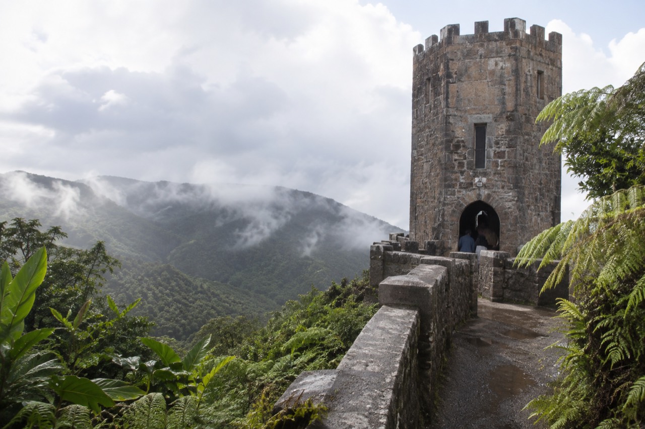
El Yunque Peak and Mount Britton Tower are the two names that come up the moment someone decides they want to actually climb something in this forest rather than ride past it. They are not interchangeable. One is the highest point visitors historically hike to, reached on a 2.6-mile trail with 1,378 feet of elevation change, and its final section is currently closed. The other is a 1.3 km climb to a stone tower built by the Civilian Conservation Corps in 1937-38, standing at 3,087 feet with a deck that, on a clear day, shows you the Atlantic on one side and the Caribbean on the other.
The complication, and the reason this page exists, is that almost no tour in El Yunque is built for summit seekers. The typical listing is a five-hour corridor run: La Coca Falls, Yokahú Tower, a river stop, back to the van. That is a fine day, but it is not a hike, and a reader who shows up in trail shoes expecting to stand on a peak will be standing in a parking area instead. This guide lays out what each summit actually requires, what is open right now, and which tours on the roster are long enough and guided enough to be worth your money if climbing is the point.
One thing worth saying at the top, because most pages get it wrong: you do not need a reservation or a ticket to enter the forest. Entrance to the PR-191 North recreational corridor is free, hours are 8:00 a.m. to 5:00 p.m., and the old recreation.gov timed-entry system no longer exists. The only thing that charges admission in the forest is El Portal Rainforest Center, at $8 for visitors 16 and over. A tour does not buy you past an entry queue, because there is no queue. What a tour buys is a permitted vehicle, a legal drop-off, someone who handles the parking problem, and a guide who knows which trails are actually open on the day, which in this forest matters more than almost anywhere else.
How Hard Is The El Yunque Peak Trail, Really?
The El Yunque Peak trail runs 2.6 miles one way with 1,378 feet of elevation change, is rated challenging by the Forest Service, and its final section, from the Los Picachos spur junction to the summit, is closed for safety reasons, so the walkable high point today is the Los Picachos platform at 3,175 feet. That is the honest headline, and it changes what you are signing up for.
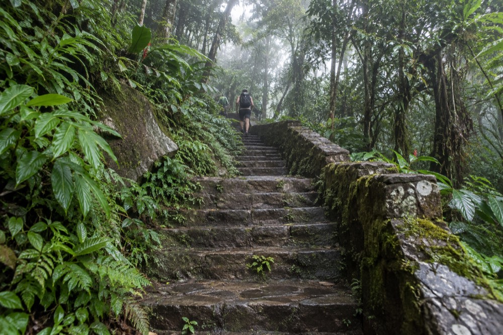
The trail is accessed via the Caimitillo or Mount Britton Spur trails from PR-191 around kilometer 12.0. The Forest Service's own difficulty label is Challenging, and the elevation number is not the whole story: much of the gain comes in sustained stone steps through cloud forest, where the air is wet, the footing is mossy, and the temperature drops as you climb. The Forest Service's preparation advice leads with footwear for exactly this reason, and its wording is blunt: wear good shoes with traction, because wet surfaces on a slope are a hazard. If you want the full packing logic, the what to wear and bring guide covers it in detail.
The closure matters commercially as much as physically. The section above Los Picachos has been closed since damage to a retaining wall was flagged, and the Forest Service's trail status alert is the live authority on whether that has changed. Trail and site closures in this forest change with construction and storm damage, so treat any status you read anywhere, including here, as a snapshot and check the official alerts page before you go. The practical consequence for a hiker is that "hiking El Yunque Peak" today means hiking to Los Picachos, a 1930s CCC stone masonry platform with a 360-degree view, at 3,175 feet. That is still a real summit experience. It is simply not the literal peak, and a tour operator promising you the peak should be asked what route they mean.
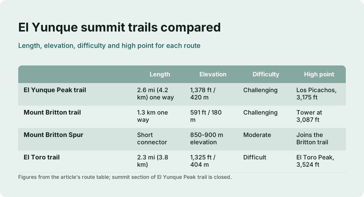
For context on how these two objectives compare against everything else you could climb here, this table puts the numbers side by side.
| Route | Length | Elevation change | Difficulty | High point |
|---|---|---|---|---|
| El Yunque Peak trail | 2.6 mi (4.2 km) one way | 1,378 ft / 420 m | Challenging | Los Picachos, 3,175 ft (summit section closed) |
| Mount Britton trail | 1.3 km one way | 591 ft / 180 m | Challenging | Tower at 3,087 ft |
| Mount Britton Spur | Short connector | 850-900 m elevation zone | Moderate | Joins the Britton trail |
| El Toro trail | 2.3 mi (3.8 km) | 1,325 ft / 404 m | Difficult | El Toro Peak, 3,524 ft |
Note the last row. El Toro, at 3,524 feet, is actually the highest peak in the forest, higher than El Yunque Peak, and it sits inside the El Toro Wilderness, the only tropical wilderness in the U.S. National Forest System. It is reached from Road 186 on the Naguabo side, a roughly three-hour hike, and almost no commercial tour goes there. If a true summit is your goal, it belongs on your radar even though it is off most tour itineraries entirely.
What Is The Mount Britton Tower Climb Like?
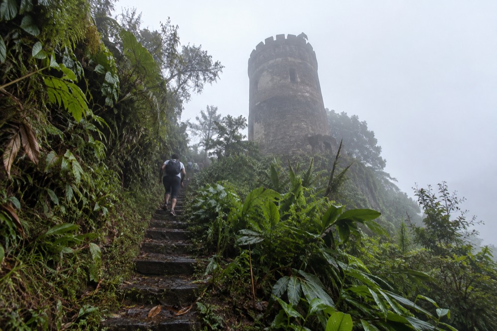
Mount Britton Tower is reached by a 1.3 km trail with 591 feet of elevation change, rated challenging, starting from a one-way loop road off the upper end of PR-191 near kilometer 13, and the stone tower at the top was built by the Civilian Conservation Corps in 1937-38 and stands at 3,087 feet. It is the shorter of the two climbs by distance but still a real workout, and it is the more reliable payoff.
The tower is the tallest of the CCC's stone masonry towers in the forest, and from its observation deck on a clear day you get a panoramic view across the forest, the Atlantic Ocean, the Caribbean Sea and the eastern coastal plain. The trail crosses two mountain streams and briefly joins Forest Service Road 10, which is closed to public vehicle traffic, before reaching the tower. Because the trailhead sits at the top of the corridor, you are already high when you start, which is why a relatively short trail still delivers a summit-grade view.
The catch for tour buyers is location. The trailhead is on a one-way loop road, PR-9938, off the southern, upper end of PR-191. That is deep in the corridor, past most of the stops on a standard sightseeing run, and it requires a vehicle that is legally allowed to drop you there and pick you up. This is one of the few places where the guided-tour case is genuinely structural rather than convenient. Rideshare apps cannot pick up at the recreational corridor or at El Portal; the Forest Service has an alert specifically warning that visitors using them have been forced to walk long distances to reach a valid pick-up point. Not every taxi holds a forest permit either, and the Forest Service tells visitors plainly to ask before hiring any transportation service. A permitted tour vehicle solves all of that.
For a reader weighing the two climbs against each other, the comparison comes down to this.
| Factor | El Yunque Peak (to Los Picachos) | Mount Britton Tower |
|---|---|---|
| Time needed | Half day for a fit hiker | 1.5 to 2 hours round trip |
| Elevation change | 1,378 ft / 420 m | 591 ft / 180 m |
| Reward | 360-degree CCC platform at 3,175 ft | Panoramic tower deck at 3,087 ft |
| Access | Via Caimitillo or Mt. Britton Spur, PR-191 km 12.0 | PR-9938 loop road off upper PR-191 |
| Status risk | Summit section closed; check alerts | Trail page shows open; check alerts |
| Tour availability | Very rare on commercial itineraries | Occasional stop on longer guided hikes |
If you are choosing one and your fitness is ordinary, Mount Britton is the smarter pick: shorter, steeper, with a guaranteed deck at the top rather than a view that depends on which section of trail is open. If you want the longer immersion in cloud forest and the bigger climb, El Yunque Peak to Los Picachos is the objective, with the caveat that you should confirm the trail status the morning you go.
If a guided hike is how you want to do this, these are three of the stronger options on the roster for a day built around walking rather than riding.
Which Tours Actually Go High Enough For A Summit Attempt?
Almost none of the mainstream El Yunque tours are built for summit hiking: the roster's long guided options run 4 to 9 hours, and the ones that genuinely hike are the 8-hour hiking adventure, the 6-hour hike with transport, the hidden waterfall hike, and the hike-and-zipline combo at 9 hours 30 minutes, while the typical 5-hour corridor tour never leaves the roadside stops. That gap between what tours sell and what a summit requires is the single biggest planning problem on this page.
Read the fine print on any listing before assuming "hike" means a hike. Many tours use the word for a ten-minute nature walk. The listings that mean it say so in the duration and the description: the 8-hour rainforest hiking adventure from San Juan, the 6-hour hiking tour with transport, and the 9 hours 30 minutes forest hike and ziplining combo are the roster's genuine hiking products. The Luquillo hike and waterslide adventure, a 4-hour hotel-pickup tour rated 4.8 across 475 reviews, is a middle case: a real trail with a river payoff, but not a summit objective.
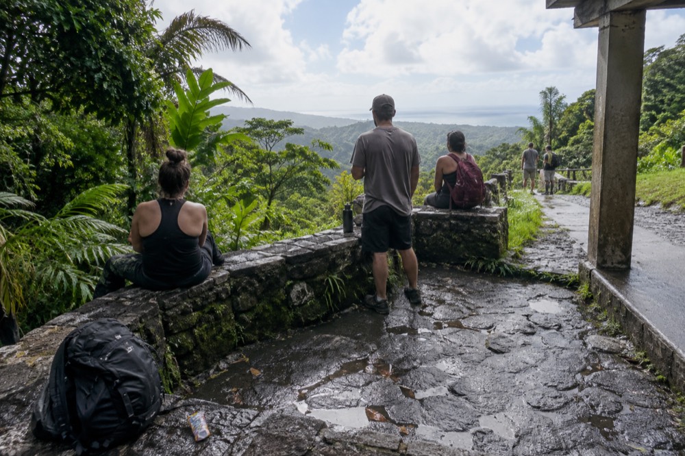
There is also a status dimension that a guide earns their fee on. The Forest Service re-issues its trail-status alerts as construction moves, and the alert covering La Mina, Big Tree and the El Yunque Peak section is the live authority on what is passable. A guide who works the corridor weekly knows which access route is open today; a page you read last month does not. That is the honest version of the tour value here: not queue-skipping, since there is no queue, but current knowledge plus a permitted vehicle at a trailhead where parking and pick-up are the real constraints. The full hiking trails guide covers the lower-elevation options if a summit turns out to be more than your group wants.
How Do The Two Summits Compare On Paper?
El Yunque Peak's walkable high point, Los Picachos at 3,175 feet, sits only slightly above the Mount Britton Tower deck at 3,087 feet, but the peak trail costs more than double the distance and elevation gain to get there, 2.6 miles and 1,378 feet against 1.3 km and 591 feet. The numbers alone say the two deliver nearly the same altitude for very different effort.
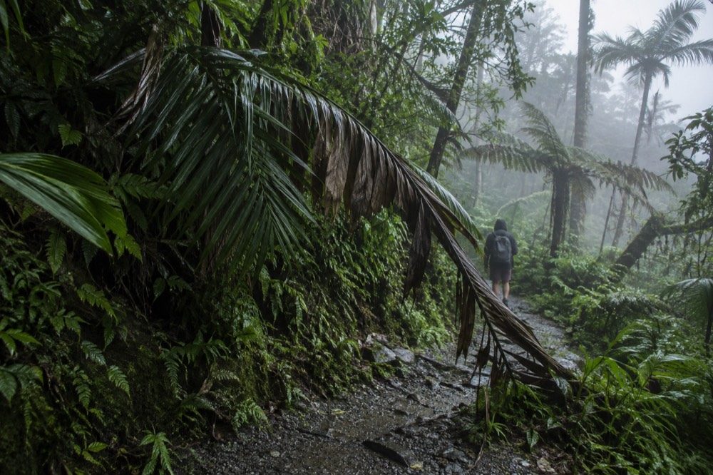
That near-tie is worth pausing on, because it is not obvious from a first page of search results. Los Picachos and the Britton Tower are, in elevation terms, practically the same place. What differs is everything around the number: the peak trail is a longer immersion in changing forest types, moving from Tabonuco forest at the bottom into Palo Colorado and then cloud forest near the top, while the Britton climb starts high and stays high, beginning near kilometer 13 where the corridor is already inside the clouds. Rainfall tells the story of what that means for your day: annual rainfall in this forest ranges from roughly 96 inches at lower elevations to over 157 inches at the higher stations, and the single La Mina station recorded annual totals varying between 147 and 254 inches across an eight-year period. You will get wet. Plan for it, and if your schedule is flexible, the best time to visit guide explains the seasonal pattern.
What Should You Know Before Committing To Either Climb?
Bring traction shoes and rain layers, start early enough to be off the trail well before the 5:00 p.m. corridor close, expect to get wet regardless of forecast, and never cross a swollen stream: flash floods here can surge to 30 feet or more and a sudden surge can claim victims in less than one minute, which is why the Forest Service repeats the warning on every trail page. None of that is boilerplate; it is the specific risk profile of a wet tropical mountain.
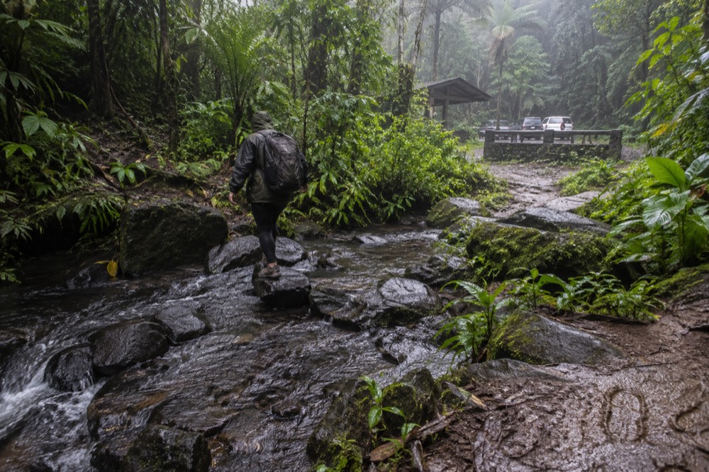
The flash-flood guidance deserves its own sentence rather than a footnote, because both of these trails cross or run beside mountain streams. The Forest Service's flooding page states that flash floods can occur throughout the year but are more frequent in the rainy months of April and May, that rapidly rising water can reach heights of 30 feet or more, and that a surge can roll boulders and vehicles. The advice is to stay alert for heavy rain upstream, not just where you are standing, and to get to higher ground rather than try to outrun water in a car. If you want to check conditions from your phone, the Río Mameyes has a live USGS stream gauge publishing real-time discharge and gage height, useful for the Luquillo-side river spots.
Timing matters as much as gear. The recreational corridor closes at 5:00 p.m. sharp, and the Forest Service advises starting your exit at least 15 minutes before closing. Both trailheads sit deep in the corridor, so a late start does not just mean heat, it means racing the gate. The how early to arrive guide covers the morning strategy, and the general timing question is treated in how many hours you need in El Yunque. For the summit hikes specifically, treat a half day as the realistic minimum including travel from San Juan.
Here is the short planning checklist for either climb.
| Item | El Yunque Peak to Los Picachos | Mount Britton Tower |
|---|---|---|
| Footwear | Traction shoes, mandatory | Traction shoes, strongly advised |
| Water | 2 liters per person minimum | 1 liter per person |
| Time buffer | Half day | 2 hours plus travel |
| Weather check | Flash-flood aware, streams on route | Two stream crossings on route |
| Exit deadline | Off trail by 4:30 p.m. | Off trail by 4:30 p.m. |
| Status check | Alerts page morning of hike | Alerts page morning of hike |
Can You Do Both Summits In One Day?
Yes, and it is a natural pairing: the Mount Britton Spur trail connects to the El Yunque Peak trail system, the two trailheads sit within a couple of kilometers of each other on upper PR-191, and a fit hiker can climb Britton Tower and walk to Los Picachos in one long morning, though the combined loop is a serious 5-plus hour effort on wet stone. Doing both is the closest thing this forest has to a classic summit day.
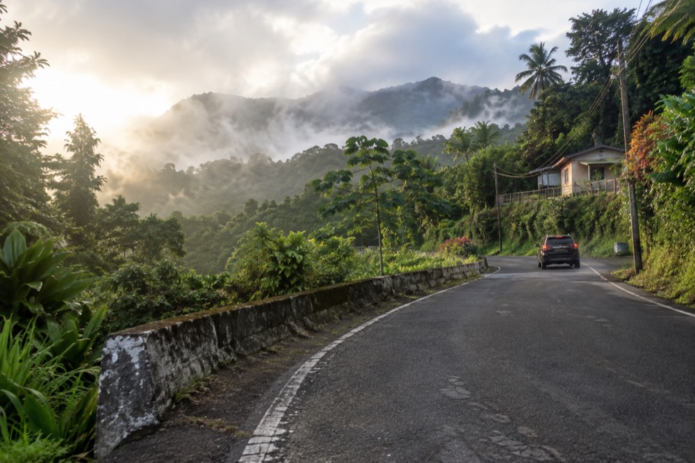
The logistics favor the pairing. Both access points are on the upper corridor, so you drive (or are driven) up once and stay high. The Britton trailhead is on the PR-9938 one-way loop near kilometer 13; the peak trail is accessed via Caimitillo or the Britton Spur around kilometer 12.0. The catch is that Caimitillo, one of the two access routes to the peak trail, has had its own closure for decommissioning work, so the Britton Spur is the more dependable approach, and even that depends on the day's status. This is exactly the scenario where a guide with a permitted vehicle and current knowledge of the access trails is worth paying for: the routing decision is genuinely nontrivial, and getting it wrong costs you the summit.
No commercial tour on the roster advertises both summits explicitly, and that is the honest state of the market. What you can buy is the long-format hiking day: the 8-hour hiking adventure, the 6-hour hike with transport, or the 9 hours 30 minutes hike-and-zipline combo, and then negotiate the route with your guide based on what is open. If you would rather not gamble on a summit at all, the lower forest has its own rewards, and the waterfall tours guide covers the river-and-pool side of the forest. For the site's wider coverage of the higher ground, start with El Yunque National Forest Tours and work outward from there.
The Luquillo hike and waterslide adventure is the roster's best middle option when a full summit day feels like too much: a real guided trail, hotel pickup, and a river finish, in four hours.
What About El Toro, The Actual Highest Peak?
El Toro Peak, at 3,524 feet, is the highest point in El Yunque National Forest, higher than El Yunque Peak itself, reached by a 2.3-mile trail with 1,325 feet of elevation change rated difficult, on Road 186 on the Naguabo side, and it sees almost no commercial traffic because the El Toro Scenic Byway carries a current condition of poor road conditions. If you want the true summit of this forest, this is it, and you will very likely be alone up there.
The El Toro trail is a roughly three-hour hike to the peak, built by the CCC in the 1930s, with the surrounding area designated a National Wilderness Area in 2005. The habitat list on the Forest Service's own trail page reads like a rare-species index: the endangered Elfin Woods Warbler, the Puerto Rican Boa, five species of coquís, and the Puerto Rican Parrot. The Road 186 approach is a 600-meter band of historic Route 186 declared a Scenic Byway by the Puerto Rican government, home of the Río Espíritu Santo watershed, and the Forest Service's standing condition note for it is simply "Poor Road Conditions. Drive Carefully."
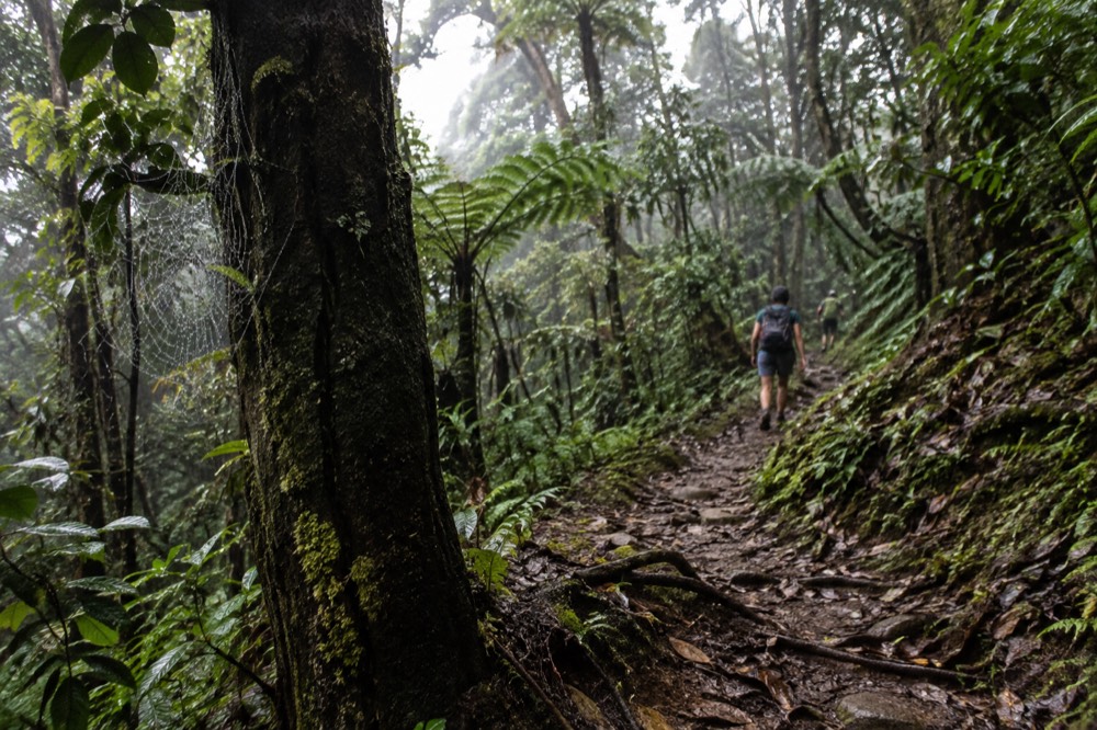
For a self-directed hiker, El Toro is the quiet prize of this forest. For a tour buyer, it is effectively off the menu, and no listing on this roster sells it. That makes it the honest answer to the reader whose real question is "what is the best hike here": the famous options are crowded and partly closed, and the highest summit in the forest is a wilderness trail most visitors never hear about. If your day allows only one guided experience and you want altitude with a safety net, the hike-and-zipline combo, at 9 hours 30 minutes the longest product on the roster, is the closest thing to a full mountain day with a guide attached.
Common Questions About El Yunque Peak And Mount Britton
Is the El Yunque Peak trail open to the summit?
The section from the Los Picachos spur trail junction to El Yunque Peak is closed for safety reasons, per the Forest Service's trail status alert, so the walkable high point is the Los Picachos platform at 3,175 feet. Closures in this forest change with construction and storm damage, so check the official alerts page on the morning of your hike.
Which is higher, El Yunque Peak or Mount Britton Tower?
The walkable high point on the El Yunque Peak route, Los Picachos at 3,175 feet, sits slightly above the Mount Britton Tower deck at 3,087 feet. The actual highest peak in the forest is neither: it is El Toro, at 3,524 feet, on the Naguabo side.
How long does the Mount Britton hike take?
The trail is 1.3 km one way with 591 feet of elevation change and is rated challenging. Most hikers need 1.5 to 2 hours round trip, plus travel time to the trailhead on the PR-9938 loop road off upper PR-191.
Do any tours go to El Yunque Peak or Mount Britton?
Very few tours are built for summit hiking. The roster's genuine hiking products run 6 to 9 hours 30 minutes, including the hiking adventure with transport and the hike-and-zipline combo. Standard 5-hour corridor tours visit roadside stops like La Coca Falls and Yokahú Tower and do not hike to either summit.
Can you hike both El Yunque Peak and Mount Britton in one day?
Yes. The Mount Britton Spur connects to the El Yunque Peak trail system, and both trailheads are on upper PR-191 within a couple of kilometers of each other. A fit hiker can do both in one long morning, though the combined effort is a serious 5-plus hours on wet stone.
Do you need a reservation to hike to El Yunque Peak?
No. Entrance to the PR-191 North recreational corridor is free and no reservation is required; hours are 8:00 a.m. to 5:00 p.m. The only fee site in the forest is El Portal Rainforest Center, at $8 for visitors 16 and over, which is separate from any trail access.
If a summit day is the goal, the three tours below are where the roster's hiking capacity is concentrated: a genuine guided trail with pickup, a gentler nature walk paired with the beach, and the long combo that turns a hike into a full mountain day.